Introducing the Baird’s Sandpiper found on the breakwater at the Duluth harbor. The bird is also known to me as Number 399. An exciting find as I thought I could get to 400 birds on my North American life list on this trip, so one done and one to go to the big celebration. You can see how well he blends into the landscape that makes the photo of this flighty bird difficult to get and I did not have my long lens with me on this short walk. I may try again in the morning with the right lens but until then, thanks for viewing.
A Meandering Kind of Day - and I Photograph a Mermaid /
The orchard was hard to leave it was such a nice spot. But off we went toward the river towns first along the Mississippi and then the St Croix. We crossed into MN and the town of Red Wing - of the shoe fame, saw the factories along the river and visited a park for our last view of the Mississippi. Then across to Wisconsin and the town of Hudson. Unfortunately our carefully planned route had a long detour but we arrived and strolled some of the main street where we found a chocolate croissant (but not as good as Cindy’s). Across to MN again now along the St Croix Scenic Byway to Osceola (WI again), Taylors Falls (MN) and St Croix (WI). Yes, it was confusing. We were able to take a short hike in the Interstate State Park (MN) to the Glacial Pot Holes and in the Interstate State Park (WI) for the River Bluff Trail and Lake O’the Dalles. We stopped for the night at a home on five acres back in MN - a Boondockers Welcome site complete with peacock.
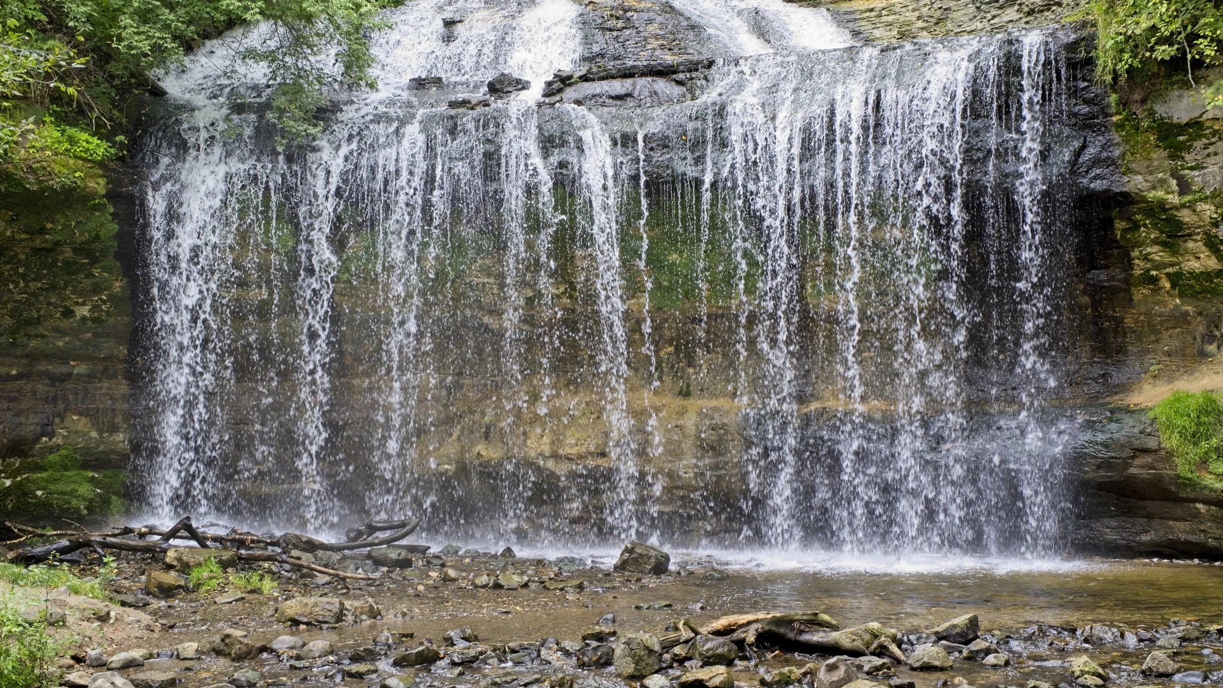
Cascades Falls near Osceola
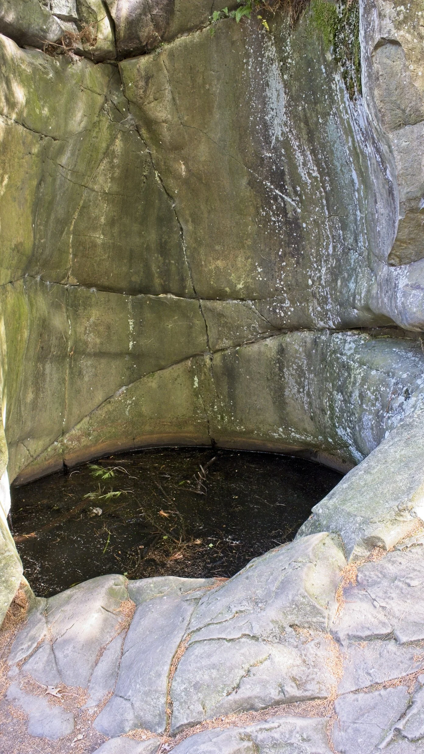
One of the pot holes. There are about 2500 from softball to house size. This one is about 8 feet across.
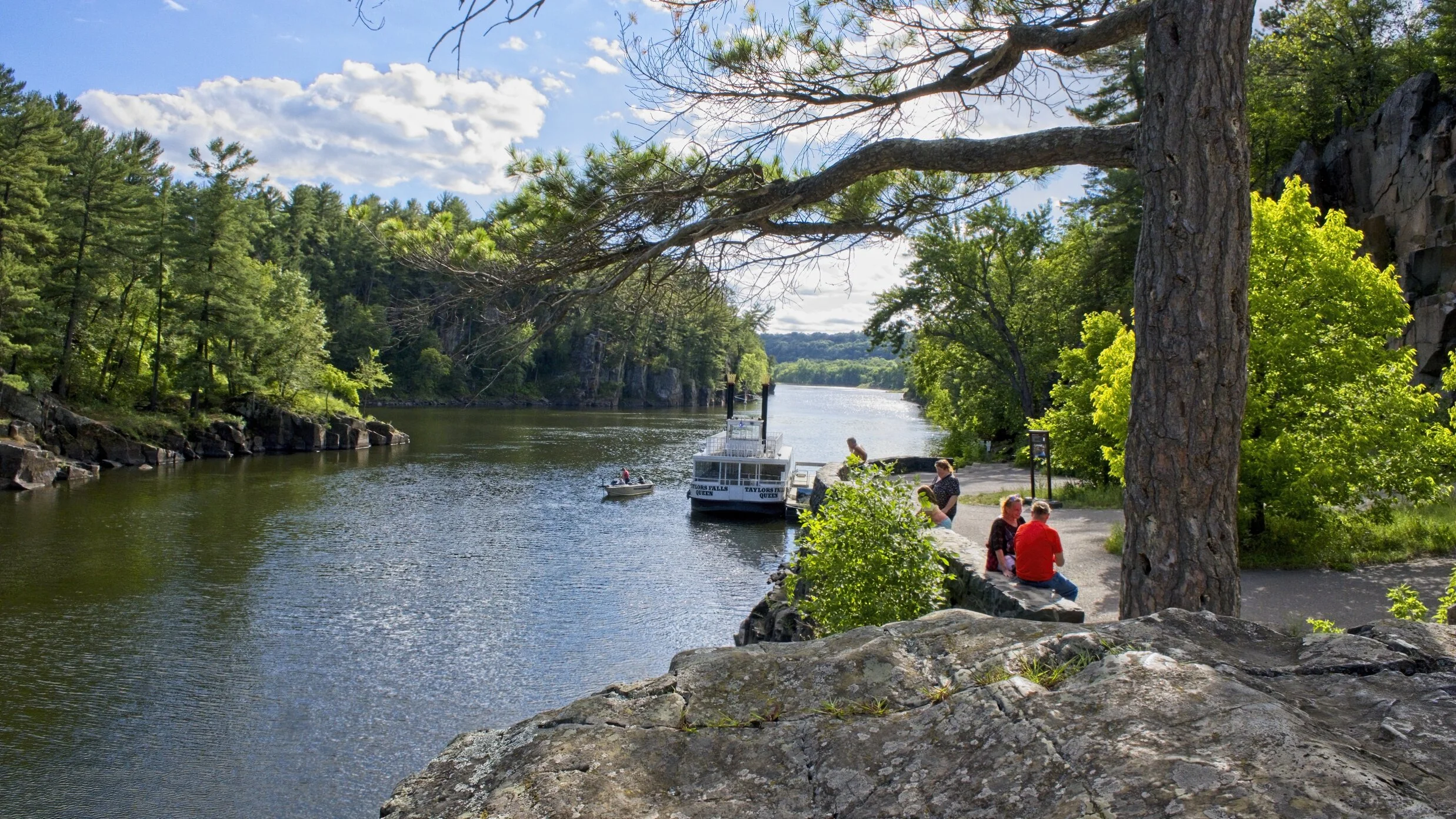
My postcard shot of the St Croix River and the waiting excursion boat.
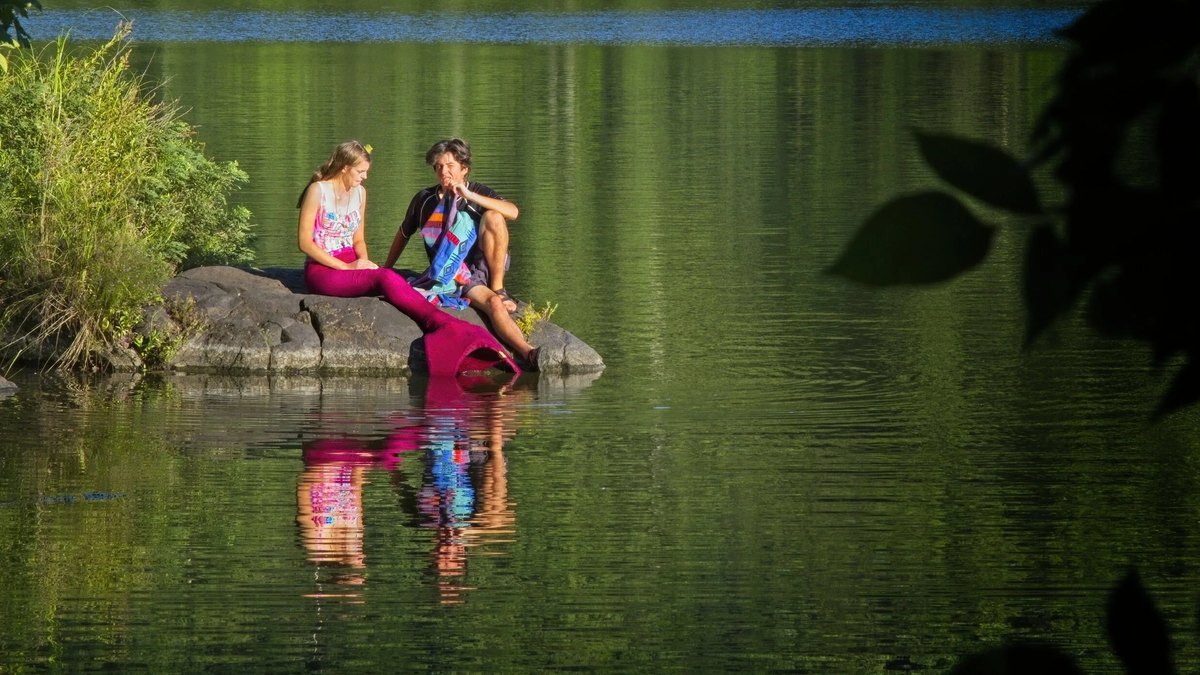
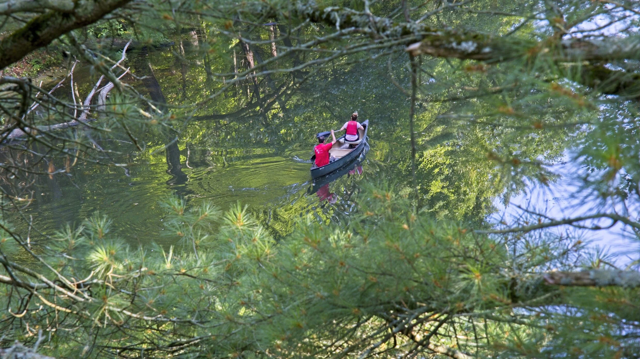
Oh, did I mention I photographed a mermaid? Walking back from the River Bluff trail across a trail that led to the Lake O’the Dalles, we spotted her. Fame awaits.
The Great River Road /
We left Mirror Lake campsite pretty late by the time we did a short hike to Pulpit Rock, I could not resist and emptied the trailer. We traveled a bit on I-90 across the Mississippi into Minnesota then headed north on the Great River Road. The scenery was gorgeous but there are no places to stop along the highway, so imagine dark green steep hills on both sides of the river and the river in deep blue with yellow/green grasses along the shore. We saw at least one eagle. Just lovely. We stopped in Winona briefly but went on to Wabasha. There we were able to stroll along the river, have a latte -first of the trip and walked a bit of the old river town. The across the bridge and back to Wisconsin with a brief stop in Stockholm, an old river town founded by and still celebrating the Swedish heritage. We spend the night at the Maiden Rock Meadery in the midst of an orchard. Tomorrow we should reach our target area for more extensive stops at some state parks, river parks and a National Scenic River.
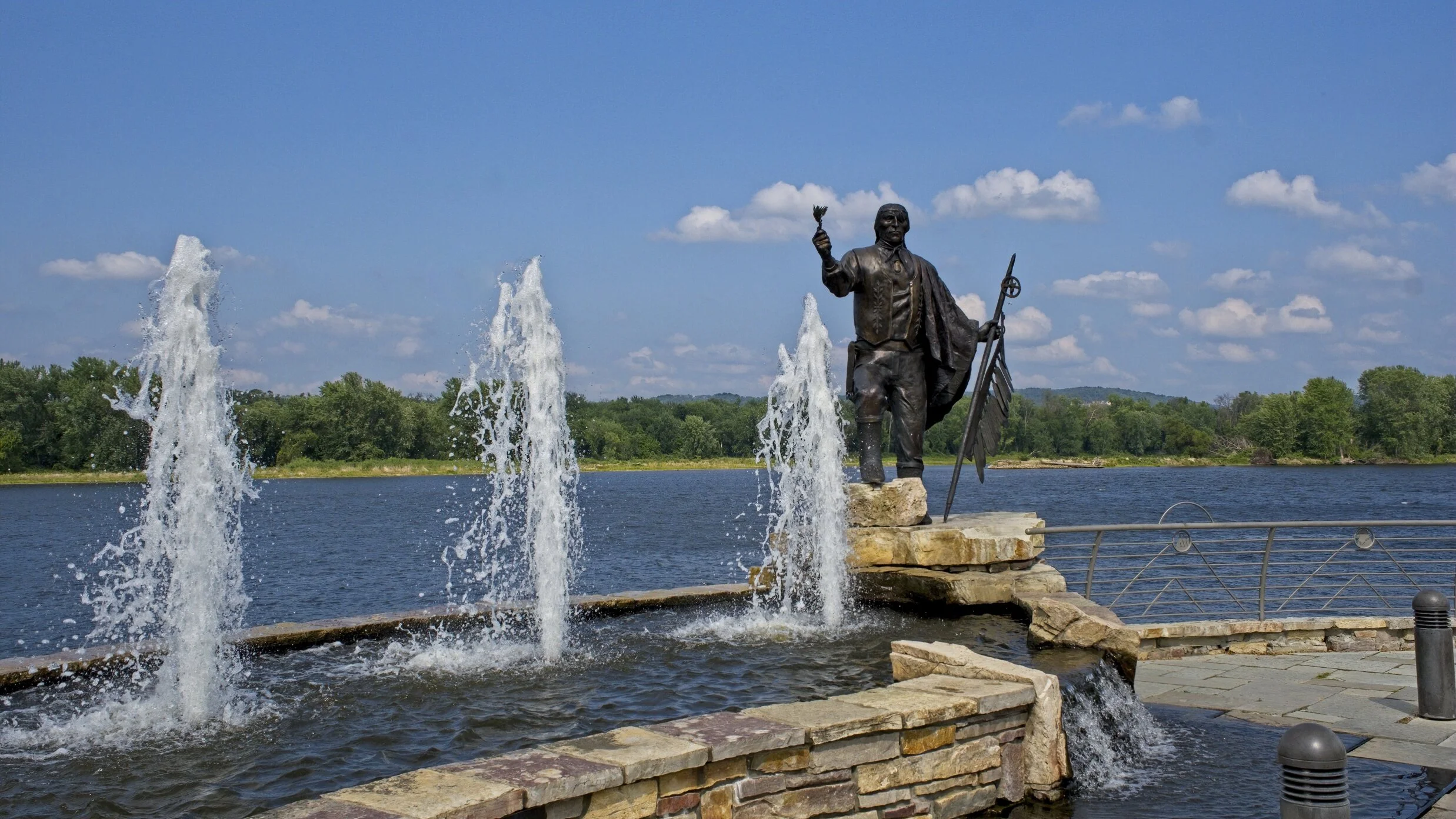
A statue to the Chief for whom the town in named, Wabasha. There were three of them and they were all outstanding leaders.
This was shot from Pulpit Rock with the canoe about 40 feet below on a small portion of Mirror Lake. Hard to see where the water, the reflections and the trees start and stop.
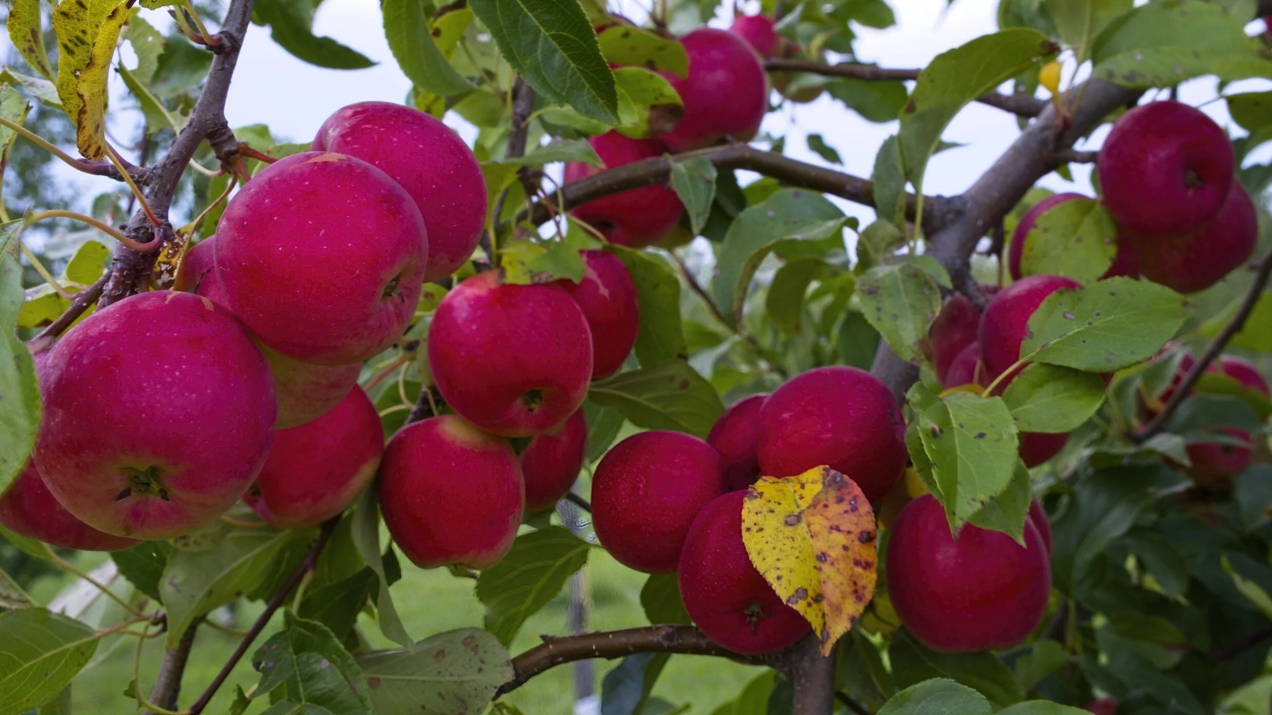
Ready to harvest in the orchard where we stayed for the night.
Beautiful Southern Wisconsin /
Nice day today both travel and weather. A bit hotter than what we anticipated but we are used to hot. And it is less humid, a bonus. The day began in a deep fog so I went into the vineyard to take some photos but it really began with Cindy exploring two different cheese shops in Monroe, WI. There are 400 dairy farms suppling milk to 13 cheese makers in this small community. At Alp & Dell she found three intriguing cheeses and at Baumgartner’s Tavern she hit the jackpot with a Wheel Swiss - apparently it is really special. Off to the Mustard Museum we were surprised by how nice it was in the middle of a neat downtown in Middleton, WI. They had hundreds of kinds in the museum along with mustard pots (some quite fancy some just fanciful) lots of information on production, growing and history. Everything was done with a light touch. Upstairs we tasted - just like a wine shop, about 10 different mustards from the 500 or so they sell. We settled for only five and it was a hard decision. Next door was a pie shop. We had a quarter piece each for lunch. Such restraint is remarkable. Then north to Mirror Lake State Park. We were glad it had power so the A/C worked. After a short walk we dressed for dinner and headed to Ishnala Supper Club. I will write a full review on that soon in Eats! As a tease, it was amazing experience, beautiful place and setting and the food exquisite. We arrived back to the trailer in time for a short walk before dark.
We were both surprised at the beauty of the rolling hills and farm lands in the region.

Early morning grapes.
Sunshine on the Horizon /
Much better day today. Thankfully. We still had a bit to travel today because of the fiasco yesterday. But we made it to our destination. Not in time for the cheese shop CJH will see in the morning but we are here, rent free at a Harvest Host and comfortable. We entered Wisconsin about 4:00 CST. Very little rain today, no headache and no forgetfulness or whatever…. Tomorrow is the day most of you have been anticipating, we visit the International Mustard Museum. Wow, just think thousands of mustards. Then to a couple of state parks, a hike or two and a famous Wisconsin Supper Club. I intend to have more photos after today, sorry about that, Dennis, best I could do.

Clearing weather over the GSMNP in the early morning.
"Yesterday All My Troubles Seemed So 'Very Real…'" /
You can hum along to the tune. Tuesday was a wash out. Totally. We hooked up in a light drizzle at 6:30 and drove in heavy rain about five hours when it just became light rain with occasional downpours. Our route up I-75 to I-64 to I-65 was fair with a lot of truck traffic, construction and some pretty poor surfaces. That was the good news of the trip. We got infested with ants at our JU stop, came in by the water line I think. Of course we did not know that until we had a few hundred guests everywhere. A stop at the Wal-mart for ant spray revealed that I did not have my wallet. Then a text from a gas station 94 miles away said they did. So grateful for the honesty and care of the folks at the Speedway in Shelbyville. Shout out to Sharon and Ben. Sharon was able to contact me because I keep a Two Lane Touring card in the wallet with my email. Think contact information may be useful. So we cut short our northern trek, found a camp site - expensive of course, and then drove back through Louisville at rush hour about 22 miles east of the town to retrieve the wallet and then back to the camp site where we had to clean up everything from the Ant Battlefield. Exhausting day with a residual headache, 12 hours of weather & difficult or at least very attentive driving, two hours short of our destination and just one that we will recall when travel seems so easy some days.
No ant photos so from yesterday the Blue Grass Band playing from the balcony at the Tennessee pre-moive entertainment. They were also in the movie for the party scene.

A Star is Born /
Cadillac’s first movie part was a smash. He is still in the special star dressing room but he will share his evening debut with all of you after his round of talk shows and news programs.
In other movie news, Lost and Found was well received, well done and a genuine treat. The premier was enhanced by the atmosphere of the renowned Tennessee Theatre but there was no doubt the movie was the real star. It ran a bit over an hour and ten minutes and packed a great modern message in those few minutes. The house was, according to my guesstimate about 2/3 full which would translate to around 1000 guests. There was a red carpet experience where photos were shot at the “step and repeat” screen created just for these shots. The evening was really special and our friend, Jill and her whole organization, shone.
Today was one of those days when you question why you ever venture out of the house - and in that vein just cannot get more written. I did not do the night justice but will try more tomorrow.

Cadillac with his favorite producer, director, composer and writer!

The Venue

Q&A after with the filmmaker (center), Jill and the five primary actors.
Elkmont /
Our friend Jill drove up to spend much of the day with us Sunday and enjoy a picnic together. We also walked back to Historic Elkmont. The homes here were mostly built between 1900 and 1920. You had to be a member of the Appalachian Club to live here. Several fo the homes were “set off” houses. The railroad would bring a house on a flatbed car and set it off with a crane for the workers. When the timbering moved from Elkmont, most. of the houses and the rr track moved to Tremont. But a few were placed for the use of the club members, the elite of Knoxville. They were occupied until about 1952 when the park bought them with a 20 year lease for those residents who wanted to stay. IN 1972 it was extended 20 years if the electrified the homes and two residents were granted additional time so the last of them ceased as summer cottages in 2002. The twelve or so buildings are along a single street where the train ran and they included the 1935 Clubhouse.

The oldest house, an 1830 cabin where the Trenthams raised 10 children.


Big wide porches seem to be on most of them

The Clubhouse, you can rent it for events still.
Impossible Green /
Friday was a travel day with a plan and, unusually the plan worked. We left early to avoid as much of the heat as possible and to arrive in Pigeon Forge about 2:00 so we had a chance at a restaurant, both seating and parking. Our choice was Five Oaks Farm Kitchen. At 2:00 the side lot was open and we had a very nice meal. Five Oaks is really good. Then with a fill up of gas we drove to the campsite in the Smokies, Elkmont. Nice site and just did a walk around the camp ground. One major plus, our new batteries work the inverter so even with no electric hookups we made coffee and used the microwave.
Saturday morning we did a long hike. Took the Little River Trail past several chimneys where houses on the Millionaire’s Row from the early 1900s. The river was very full for August. We saw only a handful of people. One fisherman walked about 2.5 miles to his spot and we watched him getting set up. The return was up, the operative word, on the Cucumber Gap trail - pretty deep forest but no vistas, and it lead to Jake’s Creek Trail by historic Elkmont. Neat the old village we agian walked past many chimneys, the only remnants of Society Hill. Historic Elkmont is tomorrow.
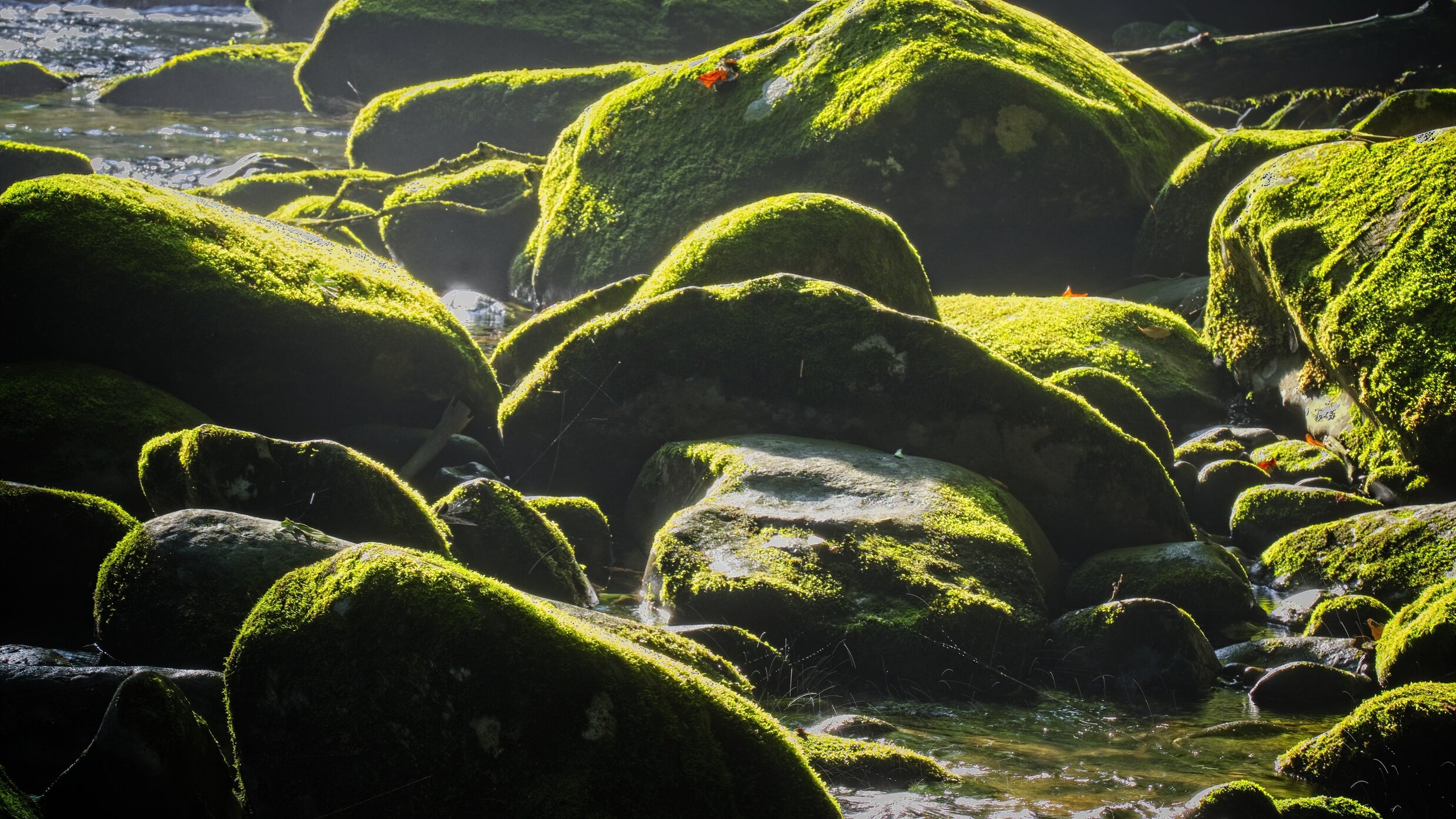
The sun was in our eyes, when it came up, along the river but this jumble of stones covered in green/yellow moss caught our eyes.
On the Road /
One of my all time favorite photographs, Witch Hole Pond, sunrise, Acadia National Park. Beside the still beauty it was a plan that worked, the only lake on the island with a sunrise perspective and I have never seen a photo of this before.
We are on our way back to Acadia, if all goes well. We are in the Smokies today, a movie premier tomorrow night and then on to parks in MN, MI and WI. We intend then to cross Canada with the recently re-opened border and to VT, NH and ME. We will be in Maine for about 18 days. Then back across New England, New York and some parks in Northern and Eastern Ohio, Pittsburgh and then through West Virginia to visit the newest National Park. As is our custom, there will be new posts from this trip every day, occasional glimpses of a moose, lots of food and ice cream and more than a few camping updates. We have friends to visit and new friends to meet. I hope you will join us. After all you don’t want to miss our visit to the International Mustard Museum, a Wisconsin Supper Club and possibly the 300th park. That will be a celebration. We have been in the GSMNP since Friday, that gives me a two-day cushion to keep the posts up-to-date.
In lieu of my usual Sunday scripture I leave you with this ancient Irish blessing & prayer:
May the road rise up to meet you.
May the wind be always at your back.
May the sun shine warm upon your face;
the rains fall soft upon your fields and until we meet again,
may God hold you in the palm of His hand.
Sunset Crater Volcano National Monument /
Just a short drive north and east of Flagstaff you will find two NP units - Wupatki National Monument and Sunset Crater. Both parks are on the same road - you come to Sunset Crater first.
The eruption that changed the landscape and the patterns of the people who lived here occurred more than 900 years ago. We went there twice, once at sunset and again the following morning. We did two short hikes across the interesting landscape. The snow capped mountains made a nice background to the black volcanic land around the hiking area.
The VC was closed, and we did not see other people. We might have missed a great hike or two but it was still a very worthwhile stop.
Cadillac’s Viewpoint: What is with the black, sharp and jaggedly rocks? My hoof needs a new mooseicure. Cadillac’s Elevation: 1.5 Antlers

A sunset photo is essential at Sunset Crater, this.is the ash cone about 1000 feet high
Ash Mountain


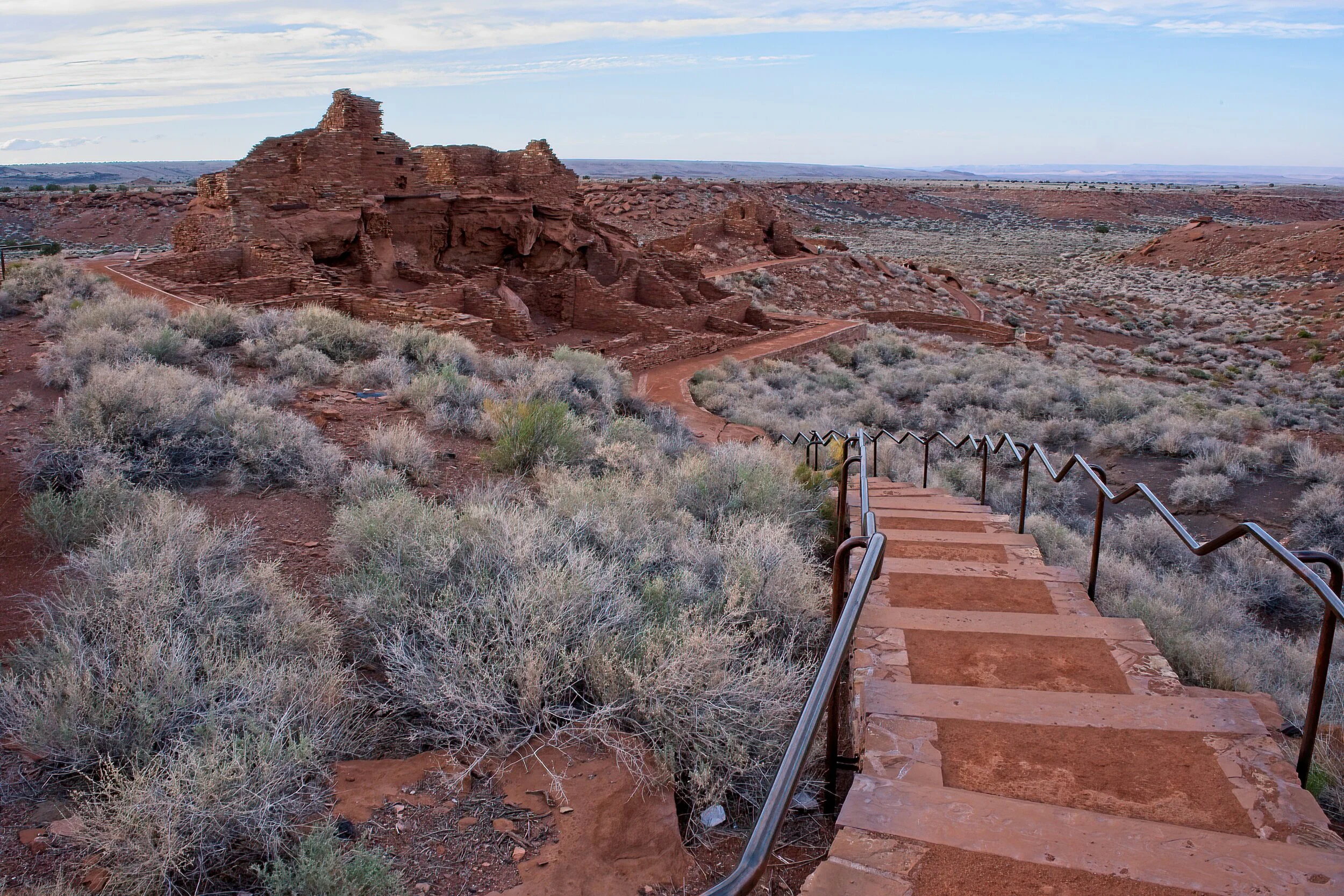
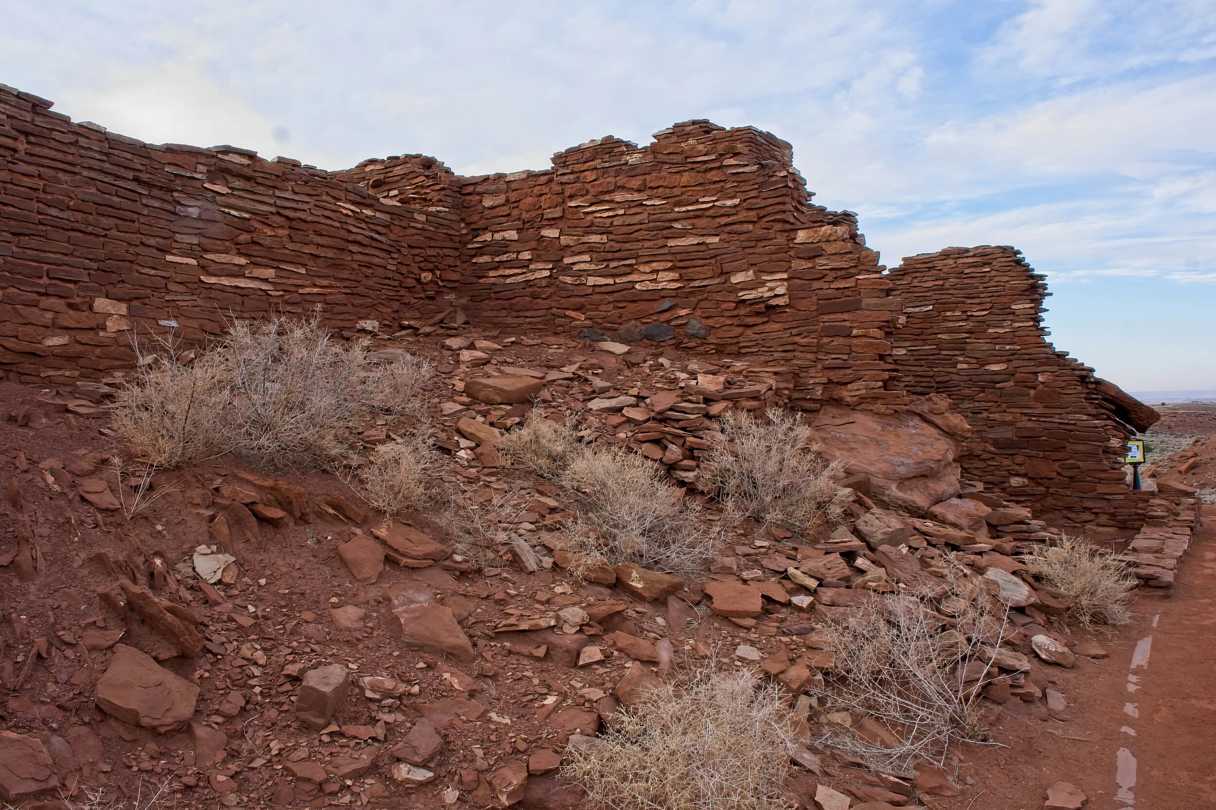
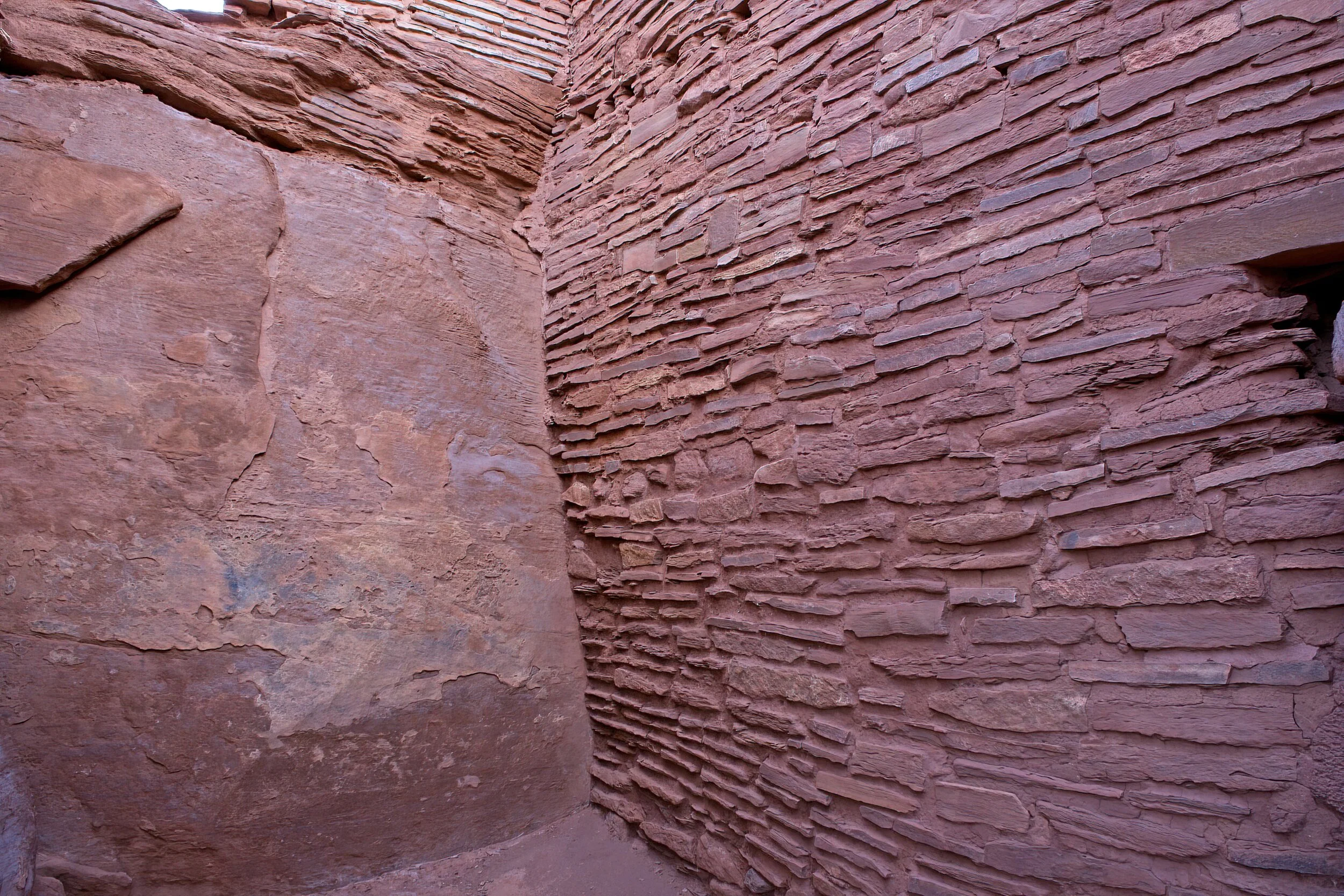
Wupatki National Monument /
A short distance from Sunset Crater is Wupatki, a pueblo in a dry and isolated portion of the Colorado Plateau. Built about 1000 and lived in for 250 years, it was home to 85 to 100 people and is considered the largest and wealthiest of the time.
This area was one of the CCC projects, and a ranger home built to blend in with the landscape in 1938 was restored and is once again a ranger home. While the original home was constructed, the ranger and his family lived in the pueblo.
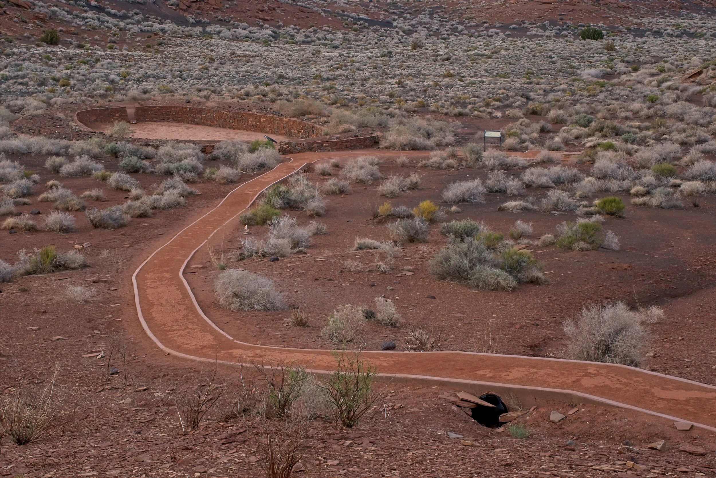
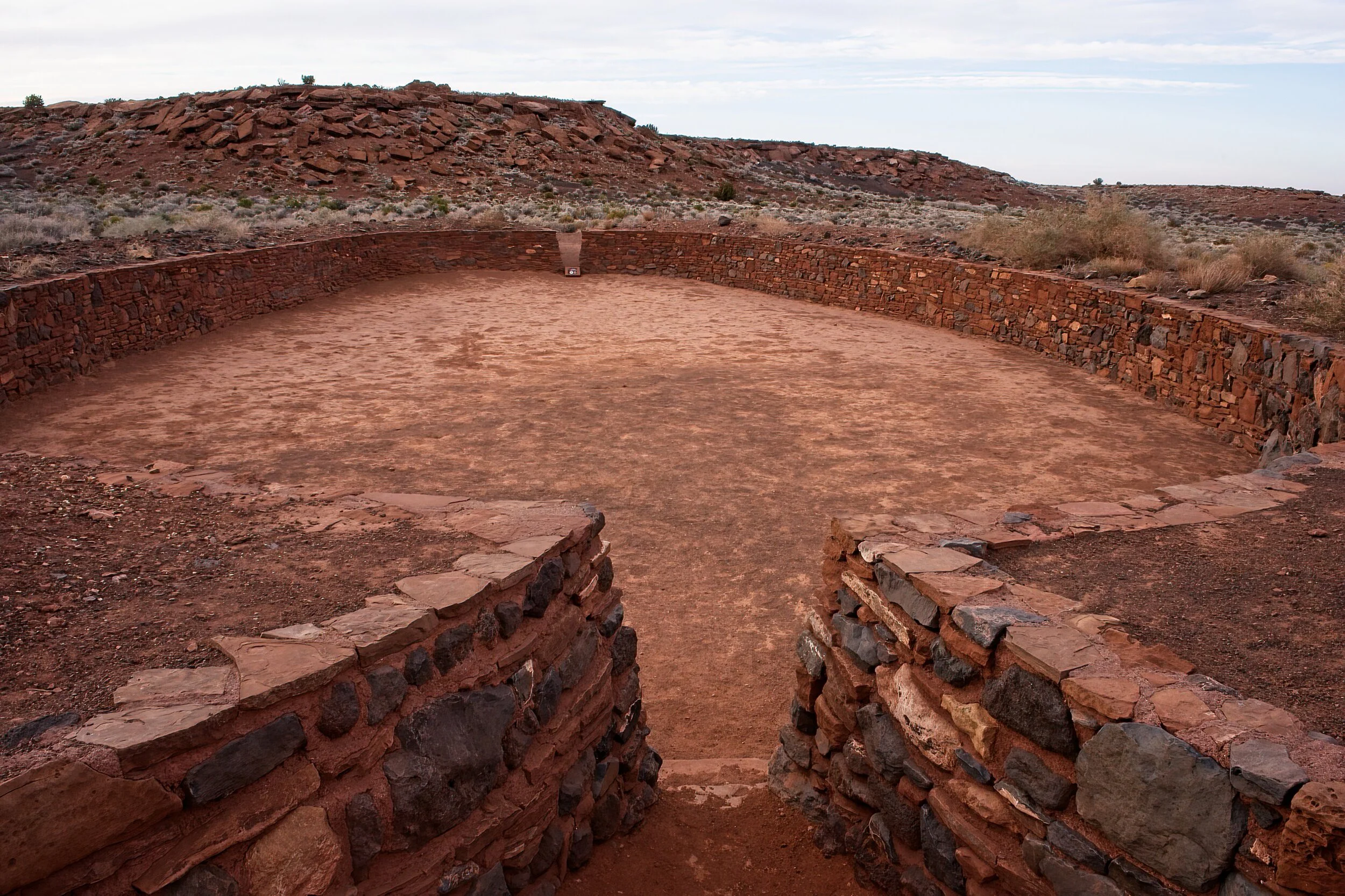
The more unique feature is the sports arena - a walled off rough oval that was used for the stick and ball games of the tribe, a critical part of their culture. The pueblo is built into a hill with stones abutting the bedrock, and the whole structure is shades of red.
Once again the VC was not open but the vistas and the drive on the loop road were by themselves worth the time and effort.
Cadillac’s Viewpoint: I am not sure what the fascination with these rocks are, but they are not cannon so small favors. Close to an actual town with real stuff, but we had to go look at rocks. Cadillac’s Elevation: 2 Antlers
Manzanar National Historic Site /
The original sign noting the site of the camp says “War Relocation Center.” It was an euphemism for the terrible treatment of the Japanese Americans, some of whom had lived for generations in the Western portion of the United States, when war was declared after Pearl Harbor. The perimeter was surrounded by barbed wire and guards in towers. The residents were not at camp voluntarily - it was a prison. 10,000 people lived here in decent but not ideal housing far from their farms and homes which were mostly along the Pacific. The camp was carefully laid out; families lived in small allotments inside the larger buildings. Each section had its own dining hall, and showers and bathrooms were built for every few homes. The internees grew 80% of their food!
This camp is near Lone Pine, CA and in the background are the Sierra Nevada range and Mount Whitney, the highest peak in the lower 48 states at just over 14,500 ft. I don’t think the beautiful scenery was any compensation to these people, many of them American citizens, who were treated so unfairly. Many left the camps by joining the army! This camp and many others like it operated from February of 1942 to the end of the war in 1945. Many who lived here lost their homes, farms, and businesses. They were given $40 and a bus ticket when the camp closed. One neat story concerned a farmer who was not of Japanese background; his neighbors on either side were, and they were sent to a camp. While they were gone, he farmed their land, paid their taxes, and handed the property and profits over to them when they were released.
I deliberately overexposed the second photo to try and show how bleak the isolated landscape was with the heat and dust and nothing green. Hard to imagine what those who arrived there experienced.
Cadillac’s Viewpoint: Zero place for me to live and too sad a story. Cadillac’s Elevation: 3 Broken Antlers

Your new home


They built a fire station (reconstruction) with their own money and fought nearly 100 fires.

Guard tower.

Dinner bell

They planted and watered and cared for plants to add beauty to their surroundings. This is still an original paint.
Walnut Canyon National Monument /
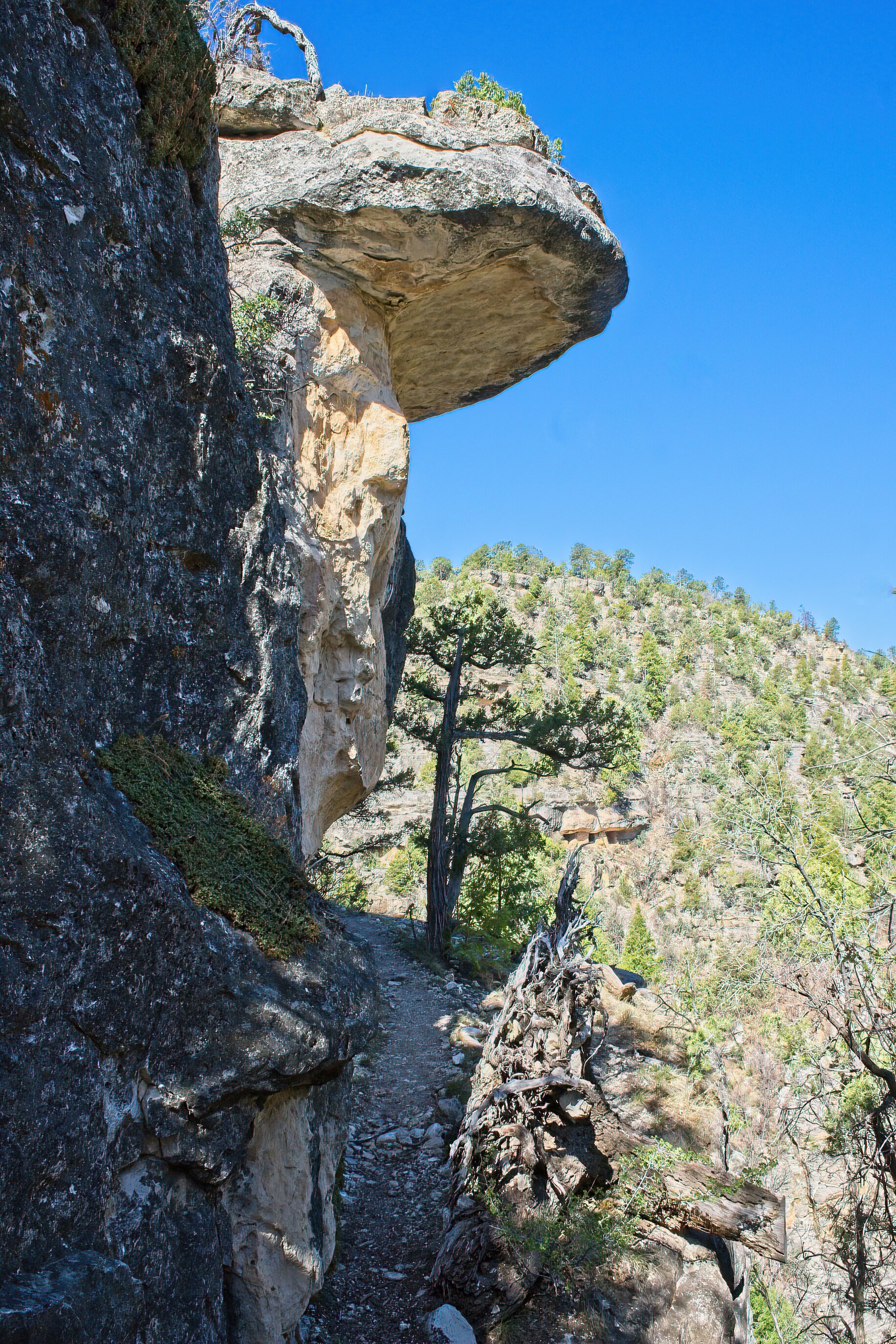
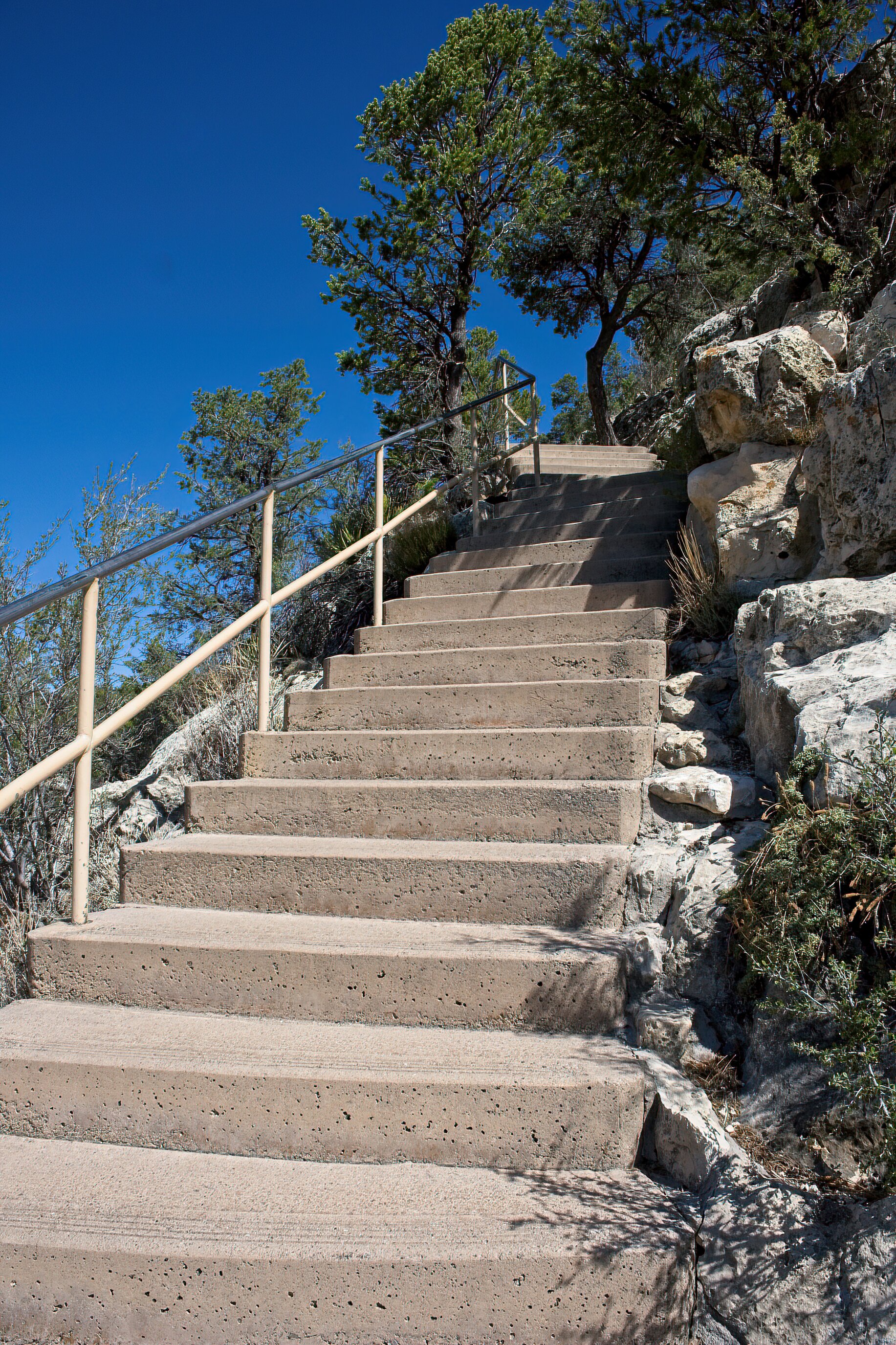
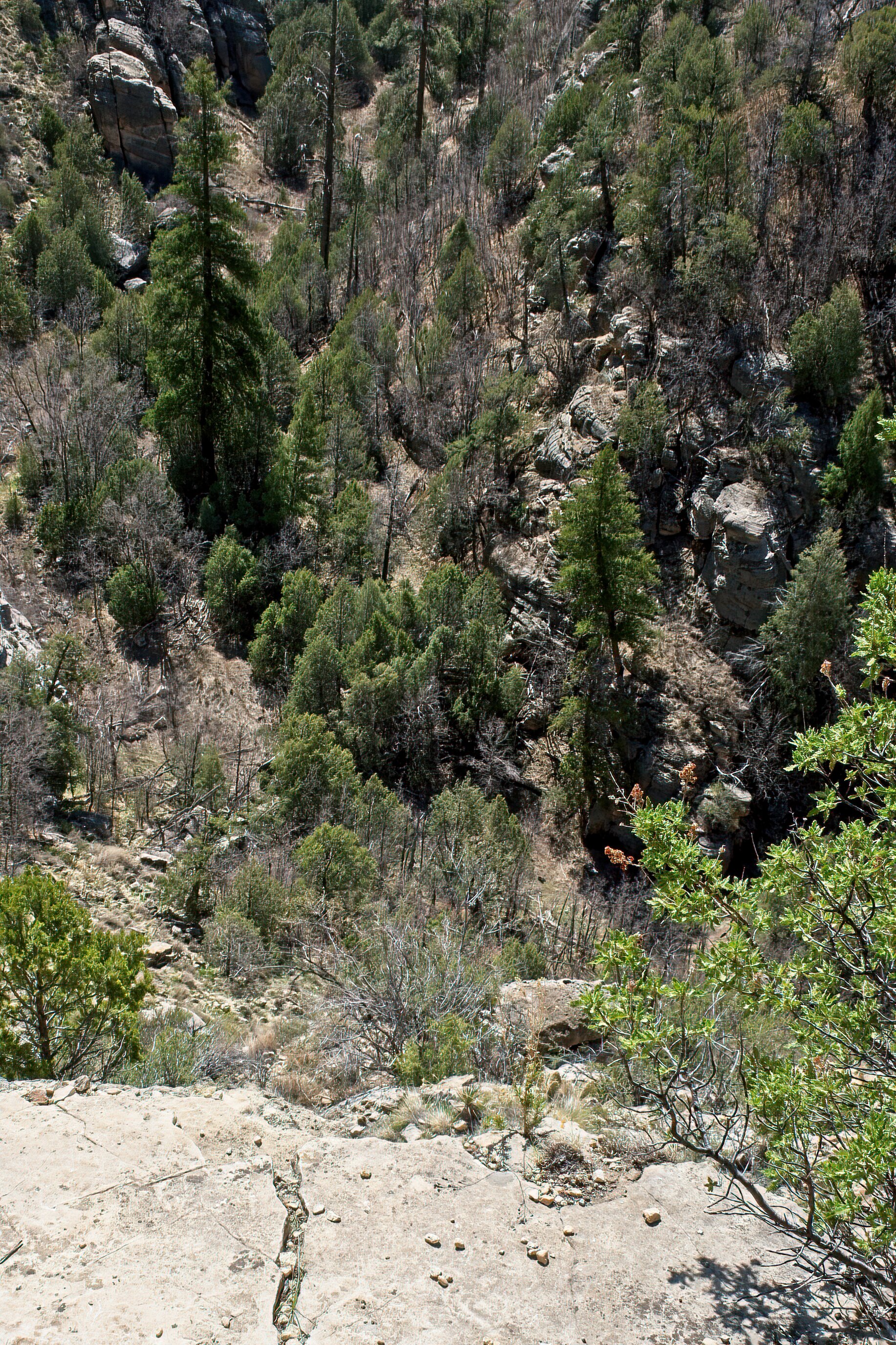
Walnut Canyon was different than other native dwellings we have visited. The route to the dwellings and their position in the canyon were unique. The informative Visitor Center is on the edge of the steep canyon. A cold, windy morning in April, about 30 degrees when we left our lodgings, caused us to reach for our warmer hats and jackets before we launched down the 200 or so steps into the canyon. Steps are steep with several viewpoints for looking into the canyon. At the primary trail, the Island Loop Trail, you cross over a small connection from the main canyon wall to a section of rock that rises from the canyon floor. There is a narrow paved path that circles this rock peninsula. The rock above stretches out over the walls, and in these niches are the remains of the rock-walled dwellings from about 900 years ago with rock paths in between. The larger homes were on the edge of the peninsula but also visible were homes on both sides and across a smaller side canyon. While they seemed close together, it was a 600-800 foot walk down and up for afternoon tea with neighbors.
The area is named Sinagua, from the old Spanish name for the region, “mountains without water.” Water had to be carried up each day, and socializing was done at the Walnut River. They grew squash, corn and beans on ledges around the dwellings. There were walnut trees which were important to the culture. The position of the dwellings was easily defended but they would have been vulnerable if prevented from getting water from the river below.
Walnut Canyon was a short, simple drive from our B&B in Flagstaff.
Cadillac’s Viewpoint: The Driver and the Kind Person started down the stairs while I was looking for the elevator. I don’t do that many stairs. Without one in sight, I spent an hour on the porch with the excellent ranger, and we discussed hats. Cadillac’s Elevation 4 Antlers
Starting on the Island Path


I bring along a red clad arm to point out things like the dwellings on the other side of the canyon


Yes, it was narrow in places

That white speck, the Visitor Center
How you get back to the VC
A peak at the river, where you went everyday for water
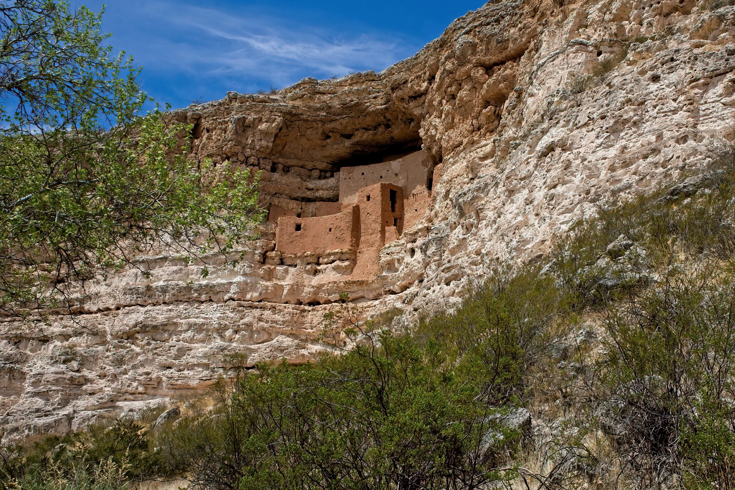
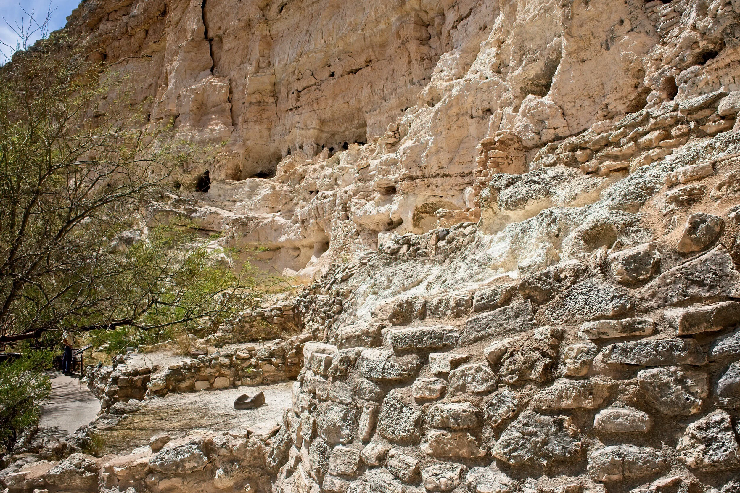
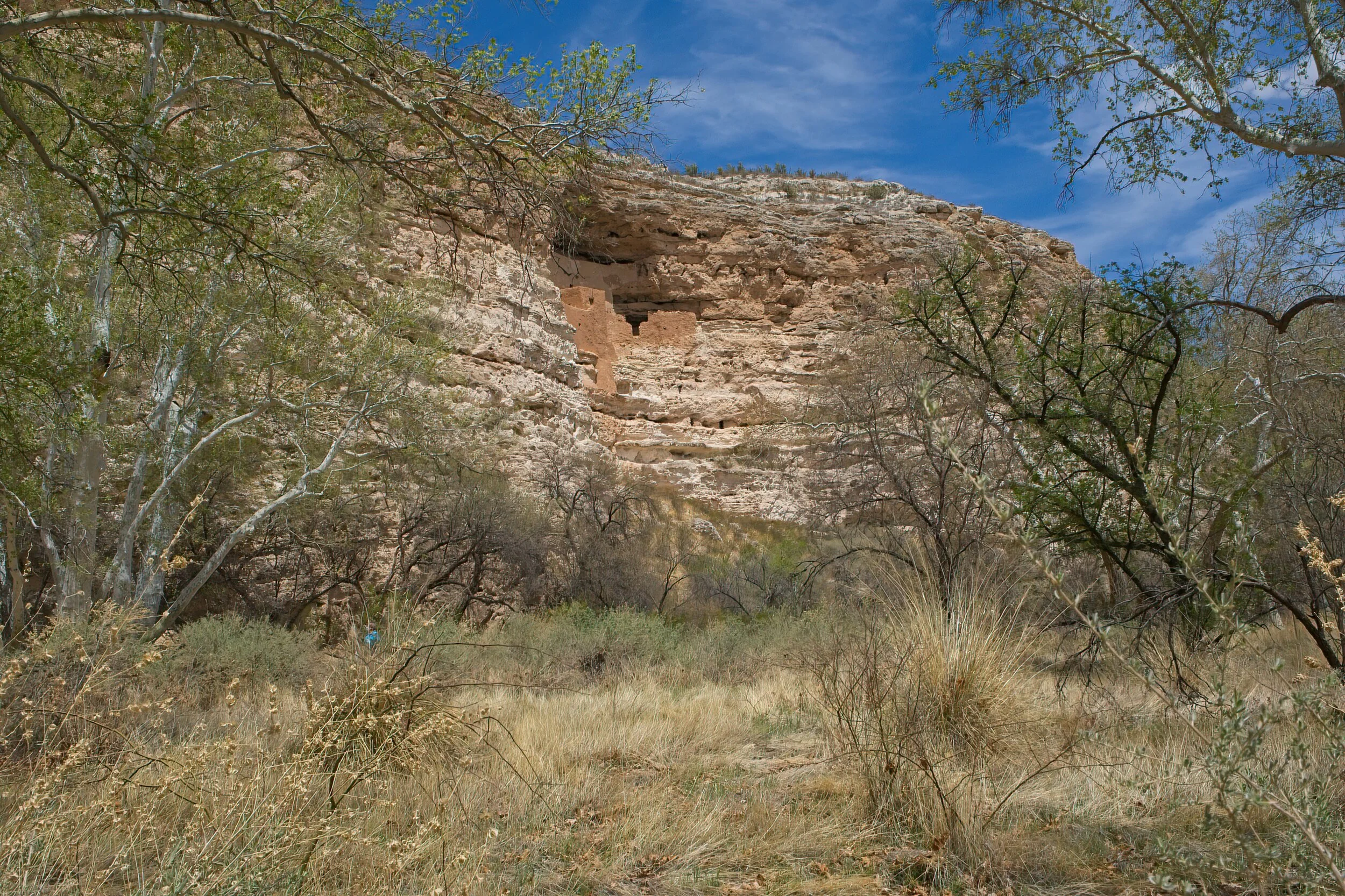
Montezuma Castle National Monument /
This park was a big deal for me. In 1960, my dad thought he had a great job offer in Phoenix, AZ. So we sold our little house and headed for what I thought - who told eleven year olds much back then - was a trip for finding a new place to live. My dad borrowed or bought a 1957 Dodge station wagon - white with a blue interior (still don’t like a blue interior). We left Pittsburgh, stayed a night with his brother in Ohio and with a friend in Illinois, and made our way to Route 66. The trip was supposed to take 6 days but they were building I-40 in New Mexico. We rode on a parallel dirt road for miles in July with no A/C with the windows up to keep out the billowing clouds of dust which made my mother ill. We stayed somewhere in a tiny motel where the owner sat outside with me and described coming west from Ohio in 1892 as a little girl in a covered wagon. I was hooked on the southwest adventure.
We spent almost a week in Phoenix, and with no explanation to the 11 year old, we were headed back east with no job - no western move for me. And I had purchased a cowboy hat! We detoured to the Grand Canyon and the Red Rocks in Colorado before going straight to Pittsburgh. I saw a sign for Montezuma Castle on the way to the Canyon, and they stopped for me to see it. I read the flyer (still have it!) until it was memorized. I was awestruck. A 1000 years ago, Indians lived here and built this and fished in the river. I must have read 500 westerns after that stop.
Clearly, I owned no camera in 1960, but now I do. It is still a magnificent place. You could not enter the structure high on a cliff in 1960, and still cannot today, but it seemed closer than my memory of it. Today you walk a nicely maintained, wide path that meanders across the valley floor, often beside a river with some smaller lower ruins. There is a nice VC and museum, lots of parking and benches for observing the castle. A worthwhile endeavor.
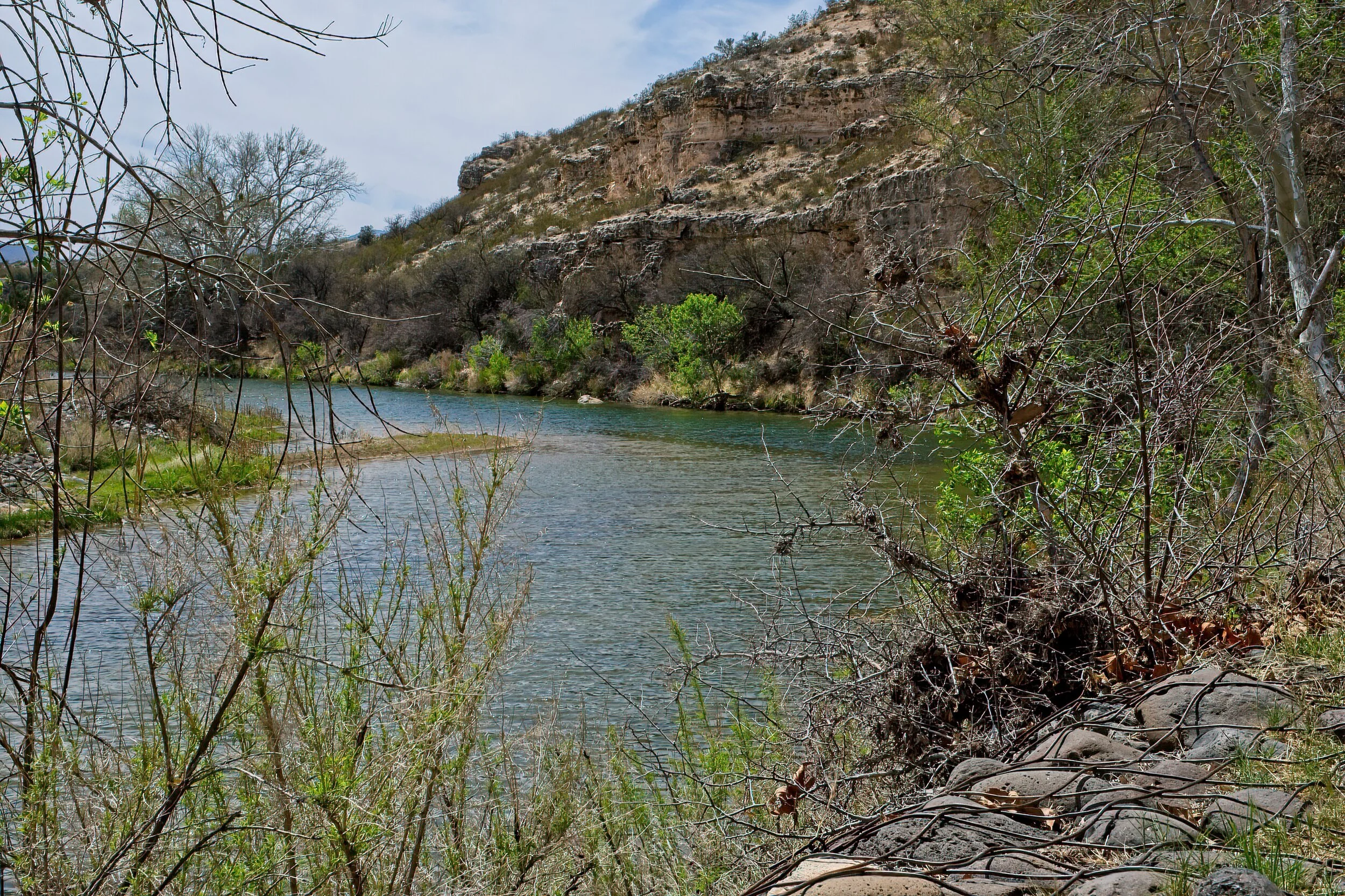
We also visited Montezuma Well a few miles away where a spring feeds constant fresh water into a deep pool. Intriguing. We were not camping on this trip and stayed in a AirBandB in Flagstaff.
The second time in this area was as fascinating to me as the first.
Cadillac’s Viewpoint: Occasionally the Driver makes a mistake and we end up actually agreeing. Not often. This was a lovely spot: perfect water, great willows and reeds, nice cool shade. My only issue was that I could not find the entrance to the elevator for the house. Cadillac’s Elevation 4.5 Antlers

Klondike Gold Rush National Historic Site /
The Skagway AK unit of the Klondike Gold Rush Park is a collection of buildings and sites interspersed with other buildings: some historic, some residential, and many gift shops with more tchotchkes than would fill up your grandmother’s china closet owned by and only open when the cruise ships were docked. I was prepared to hate it all. Did I? Nope. Well, yes on the gift shops, but Cindy immediately found a must have purse.
The back story was amazing. The Klondike Gold Rush lasted fewer than three years, from August of ’96 to 1899 with a peak of only 18 months. The shortest route to the gold fields - by a long shot - was through Skagway which grew from an outpost to a chaotic city. Dyea, next door, was also booming but today is nearly all fields and forest owned by the NPS with trails worth a visit. Tens of thousands landed but only 30,000 made it to the gold fields hundreds of miles away. A handful became rich, a small percentage paid for the trip, most lost everything. The Canadian government (gold was north of Whitehorse near Dawson in the Yukon) required nearly 2000 pounds of equipment for each person to be granted passage into Canada. Each man carried this on his back up the Chilkoot Pass in 50-60 pound packs. Up the trail, dump the load, back five miles, pick up another and repeat. 20 trips for every five miles. Horses were useless, sleds were too heavy, some dogs could assist but they required food and care. The last 500 miles were covered on boats and rafts that the prospectors hand built. It was grueling, dangerous, cold and largely unsuccessful for all but a fraction of the people who tried the journey.
The park has a good visitor center, several restored buildings, a homestead that predated the gold frenzy, and several outdoor statues and plaques in Skagway and the nearby remnant town of Dyea. You can hike a lot of the original trail, and they do not require you to carry 60 pounds of goods.
We liked the ranger tour of Jeff Smith’s Parlor. A book could be written about that character. Actually there have been several books about him. The Parlor is unique. Once a bar and headquarters of the infamous outlaw Jefferson “Soapy” Smith, it was turned into a weird museum in 1935 where it was a highly promoted part of Skagway’s tourist attractions for 30 years. It is restored to the 1960’s iteration. Wandering about the small town is the best way to discover.
One of the more popular activities is to ride the train up the Chilkoot Pass and into Canada. We opted out of this because it covered essentially the same route we took by the spectacular drive from Whitehorse in Yukon Territory, Canada where we camped for two days. Whitehorse is the largest town on the Alaskan Highway and a welcome stop on our journey.
We did take a flightseeing trip over Glacier Bay National Park from Skagway, and you can read about it HERE. We ate at Skagway Brewing Company - excellent cheese soup - and found the shops with local handcrafts to be pretty interesting.
Cadillac’s Viewpoint: What a great town! Coffee shops and oddly dressed people to watch, cool. Good watery land abounds, neighborhood moose and trains and planes and boats - my antlers are tingling with captain anticipation. Cadillac’s Elevation 5 Antlers


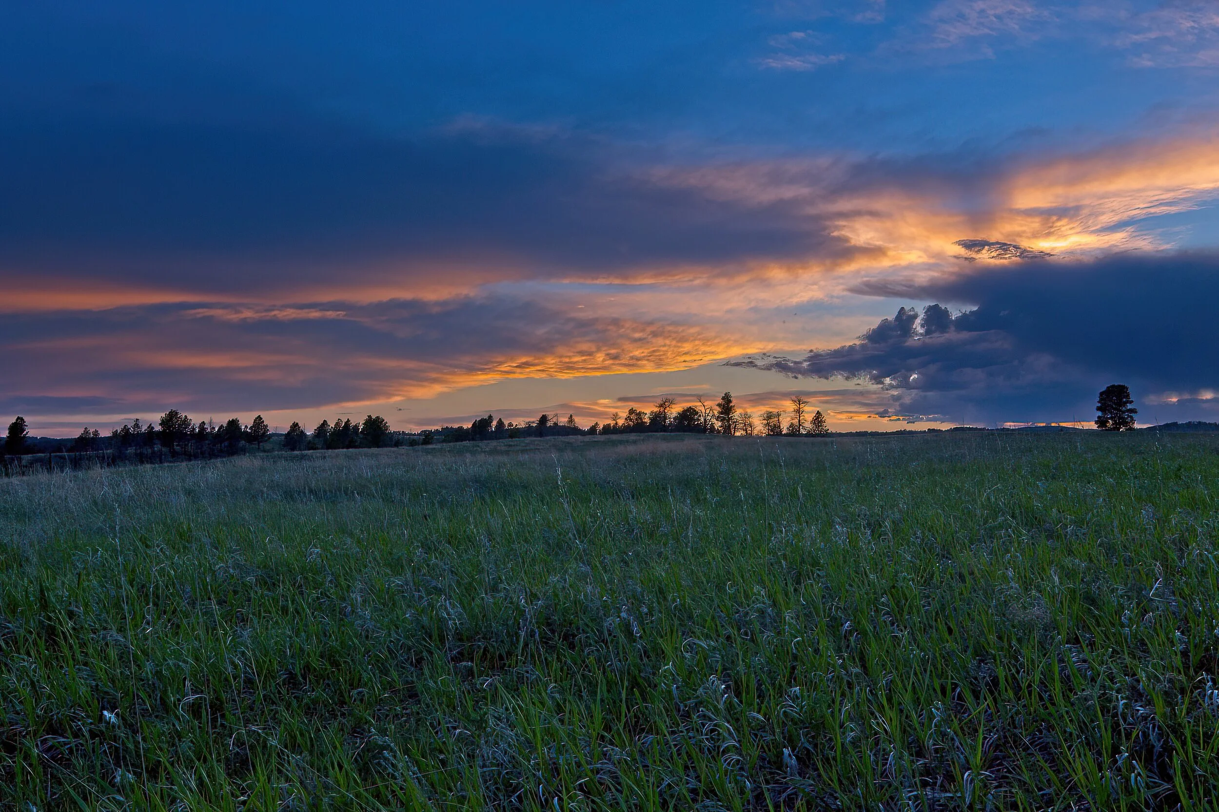
Glory /
This was taken at Wind Cave National Park in the high prairie that makes up much of the above ground aspect of the park. It was a soft night, quiet sounds, low breeze and just a touch of cool.
“O Lord, our Lord, your majestic name fills the earth!” Psalm 8:9 NLT
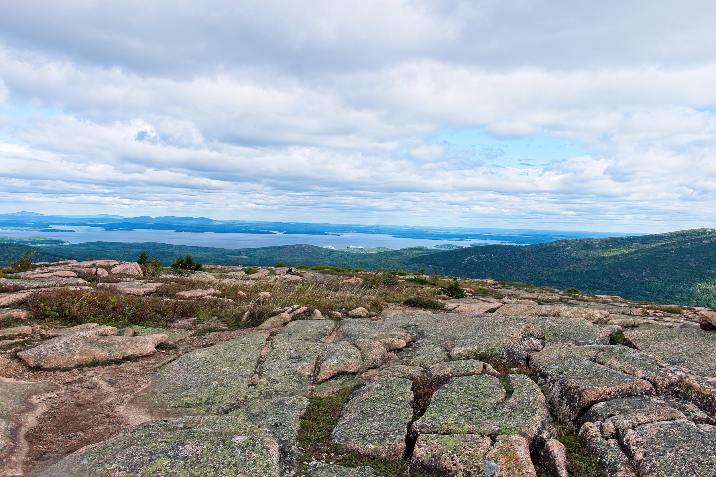
Acadia Beckens /
Our older son and family are there now completing what appears to be a very nice week. We expect to be there for about 18 days in mid-September and are looking forward to the tips.
This is from the end of the Precipice Trail looking back toward Bar Harbor on the start of the descent, one of my favorite hikes on MDI. There are two cruise ships visible in the harbor.
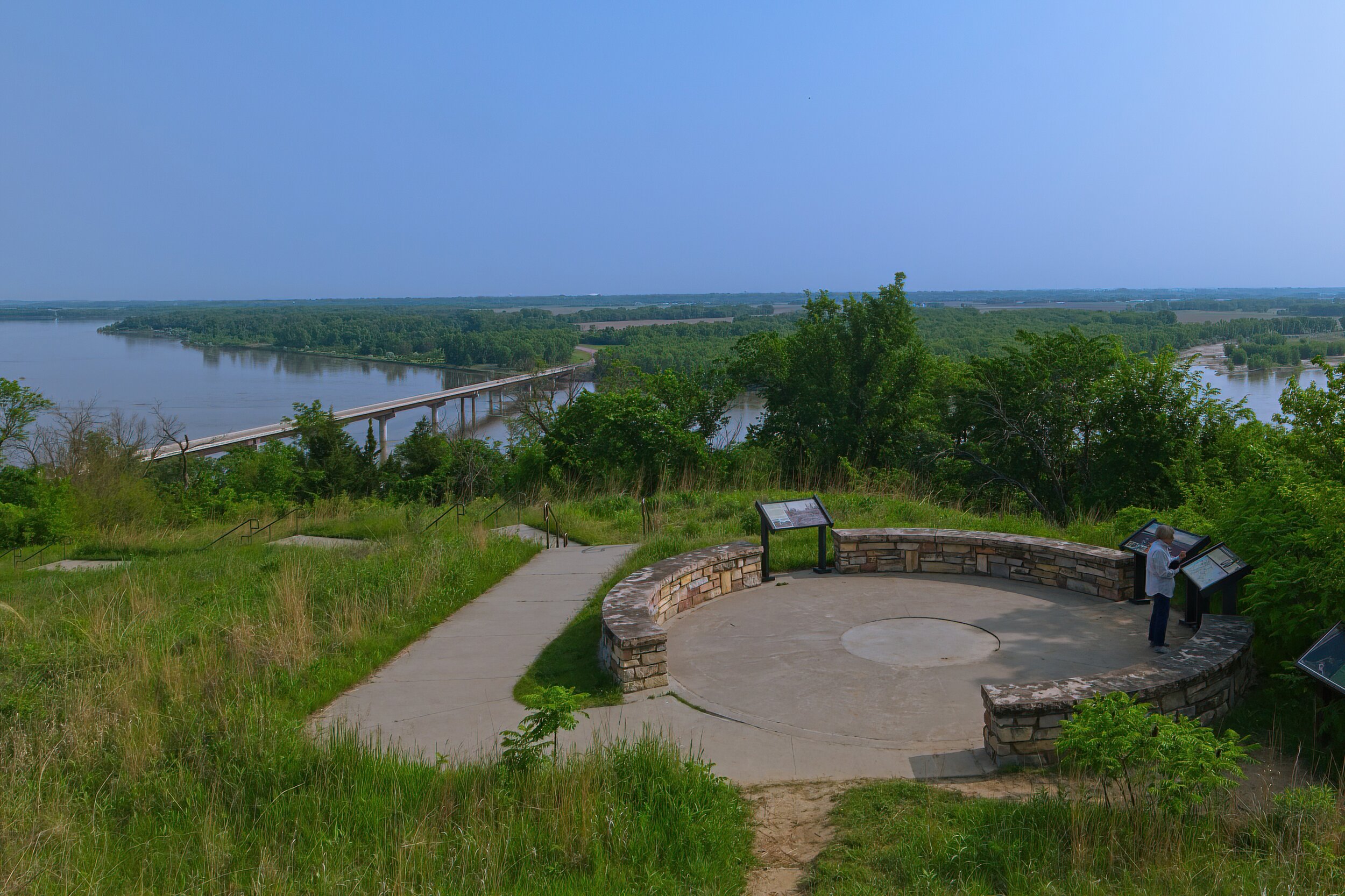
Missouri National Recreational River & Niobrara National Scenic River /
Without a boat, canoe or kayak and time to explore, National Scenic Rivers are among the least satisfying of the park service sites. We are limited to river bank views, and time seems to always be a factor. The Missouri was flooding so two of our planned sites were closed. We did find an elevated extensive view over the Missouri at Military Bend near Vermillion SD. Crossing into Nebraska, we set out to find the Niobrara River and a promised amazing bridge near Valentine. Serious disappointment. It may have been a construction marvel but it seemed ordinary today and very hard to access for a photo.
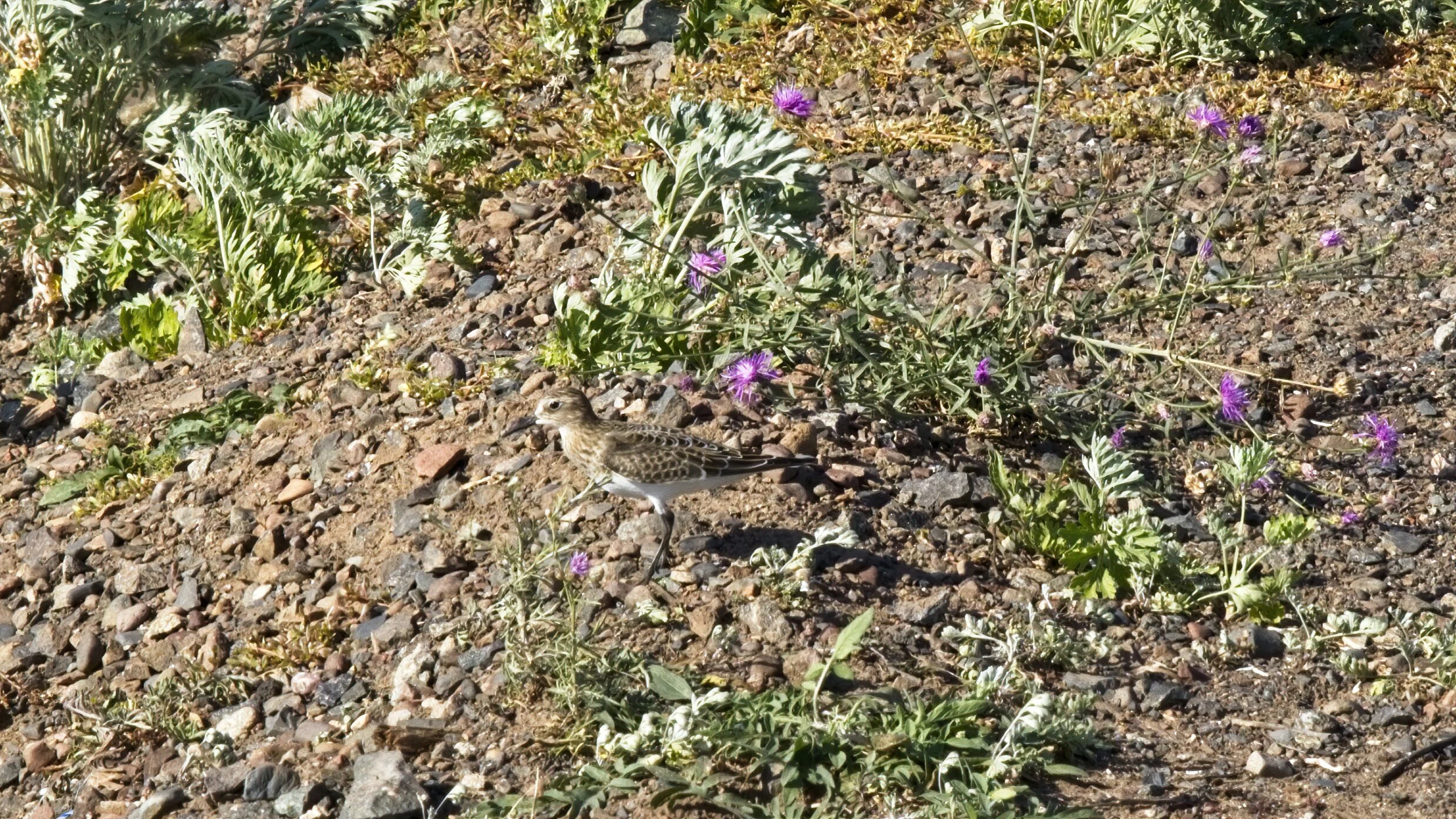
We nearly ran out of gas on the back roads to this area - another limiting factor. On the plus side, on a walk along a scenic approach to the river, I spotted and photographed my first horned lark. Yay for small victories!
Cadillac’s Viewpoint: All rivers are nice, these were a bit too large for the proper foliage growth for me to graze, but, still, rivers! Cadillac’s Elevation 2 Antlers


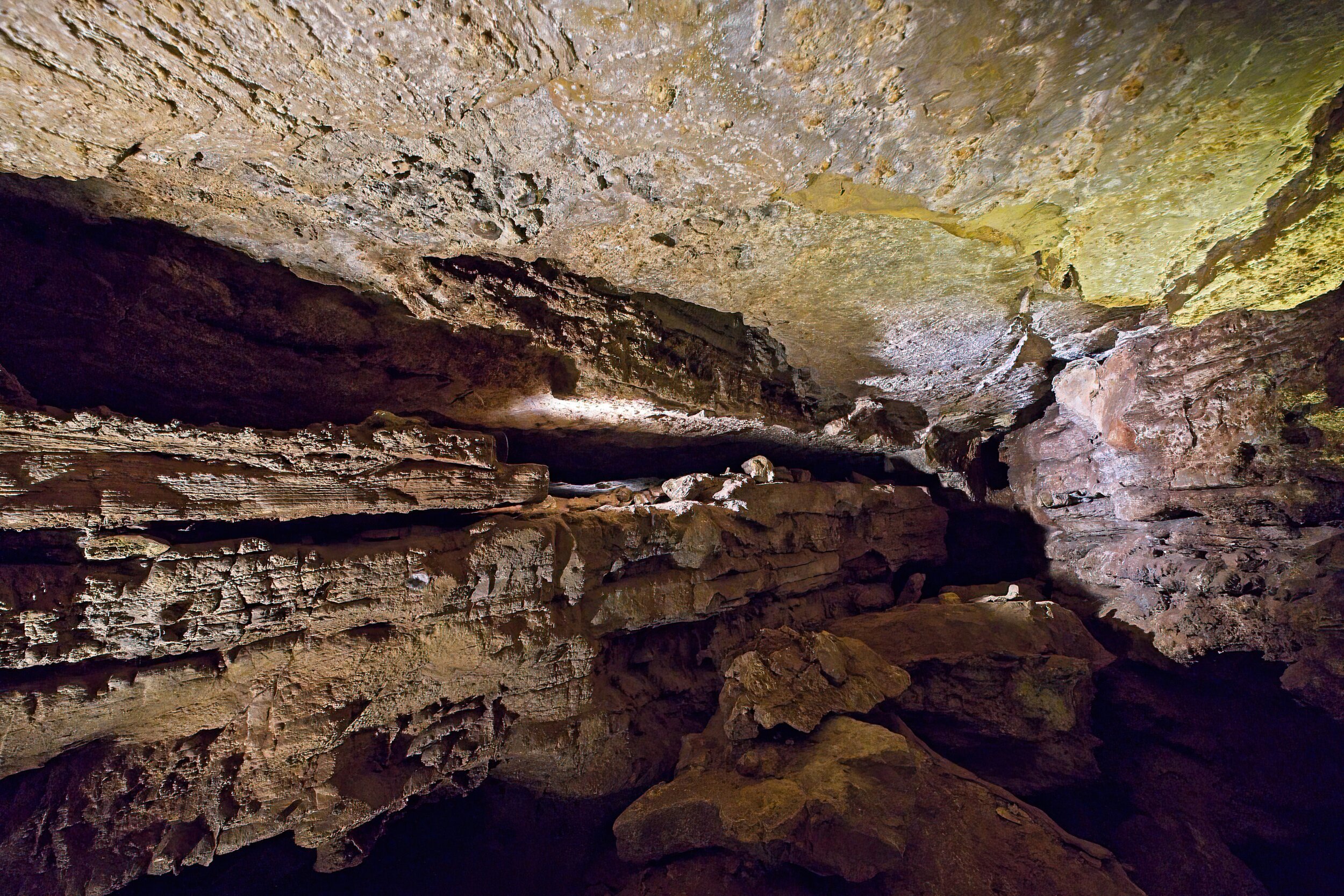
Jewel Cave National Monument & Wind Cave National Park /
These two separate parks are very close together. It is easy to visit both in a single day, and both are worth seeing. I am not sure why only Wind Cave has National Park status but it might be the extensive above ground area with wildlife and vistas. The caves are toured with a ranger, and they each have distinct characteristics and unique information presented.
Jewel Cave was named in the early 1900’s because of the calcite crystals that sparkled like jewels in the lantern light. It became protected by the government in 1908, and in 1939 the Park Service began offering tours. Later a VC and elevators were added. Until 1959, only two miles of passages were known. More recent explorations have now revealed over 208 miles; it currently ranks as the third largest cave in the world. You can join four day explorations every year as they continue to map the cave. Our tour was mainly confined to a very large space reached by a 24 story elevator descent. It is a constant 49 degrees in the cave.
Wind Cave is one of the longest and most complex caves in the world, and it has been very important to the native American cultures. Above ground are more than 30 miles of trails, lots of birds and animals, and both prairie and woodland ecosystems. You can walk to the “natural” entrance to the cave where it is easy to feel the cool wind streaming out of the cave. This tour enters through an air lock system, and the descent into the cave is by way of steps - quite a few of them - the lighting is very low so it is occasionally difficult to see your footing. Rare boxwork formations are seen on the ceilings.
Southwestern South Dakota is a beautiful place with much to see. We came back to the grasslands at Wind Cave for a nice sunset.
We had a great dinner at the Black Hills Burger and Bun Co in the town of Custer. We also visited Mount Rushmore between the two cave experiences. We camped at the KOA nearby in retrospect we wish we had stayed at Custer State Park. KOA was ok but pretty expensive.
Cadillac’s Viewpoint: I do NOT do caves like this. I am not a ground hog and simply refuse to act like one. Cadillac’s Elevation 0 Antler

One of the large rooms in Jewel Cave


Platforms in the Jewel Cave

Grasslands over the Wind Cave National Park

The “natural” entrance to Wind Cave